Padstow to Portcothan - Wednesday 25th April 2012
Path Facts - Length: 13.5 miles, Ascent: 2500 feet
For several days the weather forecast had been promising a huge swirling mass of rain and wind crossing the country. Although the estimate of it's arrival had been put back a few times last night's forecast more than hinted that today was going to be the actual day. Just before a breakfast a heavy shower hit.
Breakfast in the Golden Lion was accompanied by a small Westie type dog frantically barking and paddling at the window at the presence of a passing Afghan Hound. A regular occurrence apparently.
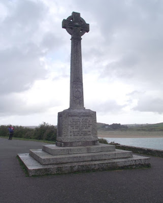
The path picks up again near the war memorial in Padstow. The skies were still pretty dark but luckily it turned out that the worst of the real storms had passed the West Country in the early morning and were heading further East.
The first part of the path follows the opposite bank of the Camel from yesterday and views back to Polzeath and Pentire Point were evident.
After a while we caught up with one of the obvious landmarks spotted yesterday. At Stepper Point there is a large chimney like structure which looks like it could be to do with a mine but is actually called a daymark. This is essentially a navigation aid like a lighthouse without the light.
New views opened up out towards Trevose Head here.
There were some pretty awesome stretches of path here. When you're walking you don't necessarily see how close you are to a precipitous drop until you get a different perspective (spot Andy in the second photo below).
Cows... lying down... behind a wall... oh-oh...
Given that day was going to be fairly long and possibly "marginally inclement" it was lucky that there were quite a few possibilities for stops. Trevone had a small surfer's cafe which was good for a tea stop. There were a group of older walkers at Trevone, the kind of people that have a temperament that has transcended the sort of sun=good, rain=bad thinking and were cheerful regardless.
At Trevone is what is marked on the map as a "hole" and we later found out is a collapsed cave. Quite impressive. Looks like a crater and it wouldn't be the only one we'd see today. The Trevone "hole" can be seen on the hillside on the photo below.
A bit further along is Harlyn Bay where we stopped for lunch in a pub. This had the feel of a place that is probably surfer-ville in the appropriate season but if anyone was in two minds about visiting Cornwall and had watched the weather forecast on TV, they were definitely staying away.
Saw a kestrel today, initially hanging in the air waiting to swoop then eating it's catch near the cliffside.
On the approach to Trevose Head there were some great views back to Stepper Point and Pentire Point.
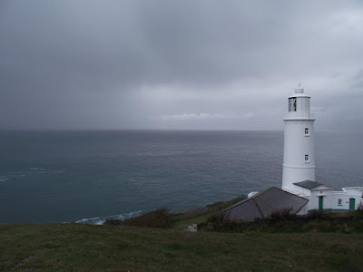
Then the final approach to the lighthouse...
...which felt like a pretty major landmark.
The rain had been intermittent most of the day. As the the views are pretty spacious it is possible to see the rain clouds coming from quite a way off. The descent into the large expanse of Constantine Bay was accompanied by some heavy showers.
But the bay itself looked really dramatic with the mixture of sun and rain - reminiscent of the highlands of Scotland with the usual mixture of several seasons simultaneously.
Stopped again for a rest, partial dry off and more tea at the Youth Hostel at Treyarnon Bay.
Then the next bay coming into view was the welcome sight of Porthcothan.
Porthcothan is a pretty small place and looks quite well-to-do. The B&B is the only one to my knowledge. After ablutions and a chance to start some gear drying off we headed up to the local hostelry for food and a pint. Not a bad view for the end of the day.
Info:
Accommodation – Penlan
Location ****
Room ***
Facilities ***
Noise *****
Food ***
Ambience ***
Price *** £70 for the room
Food - The Tredea Inn
Quality ****More pizza and Mexican
Price ***
Beer
Betty Stoggs ****


No comments:
Post a Comment